Uji, Kyoto
Amagase Dam
A wider Uji-area route extension for Sound! Euphonium visitors who want hillside, river, and infrastructure context beyond the central bridge loop.
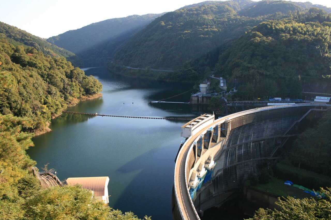
About this stop
Why fans visit Amagase Dam
A wider Uji-area route extension for Sound! Euphonium visitors who want hillside, river, and infrastructure context beyond the central bridge loop.
From Uji Station, allow about 45 minutes on foot to reach Amagase Dam. Check the map for the final block because small slopes, one-way streets, or shrine paths can change the last approach. Safety fences limit angles; compare overall valley shape instead of forcing a tight match.
Amagase Dam is a visual-match stop for Sound! Euphonium travelers fans. A wider Uji-area route extension for Sound! Euphonium visitors who want hillside, river, and infrastructure context beyond the central bridge loop. Dam and infrastructure stops may have restricted zones; follow posted safety lines and staff directions.
Short photos are fine; long staged sessions or tripods should move to less crowded corners.
The Amagase Dam (天ヶ瀬ダム) is an arch dam on the Uji River just upstream from Uji, Kyoto Prefecture, Japan. The main purpose of the dam is flood control but it supports a hydroelectric power station and creates the lower reservoir for the Kisenyama Pumped Storage Plant. The dam itself serves a 92 MW power station while the pumped-storage power station upstream has a 466 MW capacity. Construction on the dam began in 1955 and it was complete in 1964. The pumped-storage power station became operational in 1970. Both plants are owned by Kansai Electric Power Company.
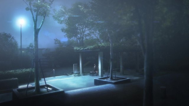
Scene comparison
Real location vs anime scene
Visit basics
- Address
- Uji, Kyoto
- Nearest station
- Uji Station
- Walk time
- 45 minutes
- Coordinates
- 34.9074, 135.8206
- Related anime
- Sound! Euphonium
- City guide
- Uji anime locations
On-site experience
What it feels like to visit
Fans of Sound! Euphonium often mention Amagase Dam because of a specific atmosphere — a wider uji-area route extension for sound! euphonium visitors who want hillside, river, and infrastructure context beyond the central bridge loop.
Compare that atmosphere with what you see on site today; shops, seasons, and renovation can shift details while the broader place identity remains useful.
How to get there
From Uji Station (45 min walk)
From Uji Station, walk roughly 45 minutes on public streets toward Uji, Kyoto. Final blocks may involve stairs, shrine paths, or one-way lanes not obvious from the map zoom level.
Check return trains before you leave Uji Station; Uji routes get harder to extend once you are far from the main line.
- Start at Uji Station and pick the exit that shortest-walk maps to Uji, Kyoto.
- Walk the normal pedestrian route for about 45 minutes, keeping to marked sidewalks and shrine or temple approaches.
- Pause where foot traffic allows, compare the scene cue with a wide shot, then move on if the area gets crowded.
- Connect to the next Uji location on the map if time allows.
Quick visit note
From Uji Station, allow about 45 minutes on foot to reach Amagase Dam. Check the map for the final block because small slopes, one-way streets, or shrine paths can change the last approach. Safety fences limit angles; compare overall valley shape instead of forcing a tight match.
Etiquette
Short photos are fine; long staged sessions or tripods should move to less crowded corners.
Nearby in Uji
More stops on the same route

Keihan Uji Station
A practical Sound! Euphonium starting point before crossing into river, bridge, and school-route atmosphere.
Uji Bridge
A river-crossing landmark for Sound! Euphonium routes, especially useful for bridge-to-station walking notes.
Agata Shrine
A compact shrine stop that helps Sound! Euphonium visitors vary the route beyond river and station views.
Daikichiyama Observation Deck
A hillside view stop for Sound! Euphonium fans who want a payoff beyond the flat riverside route.