Suwa, Nagano
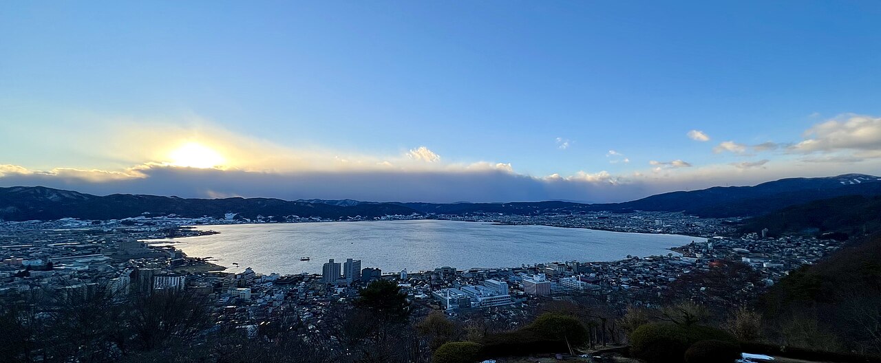
Lake Suwa Viewpoint
A wide lake-and-basin view used by fans as a landscape comparison route for Your Name-inspired travel.
About this stop
Why fans visit Lake Suwa Viewpoint
A wide lake-and-basin view used by fans as a landscape comparison route for Your Name-inspired travel.
From Kamisuwa Station, allow about 18 minutes on foot to reach Lake Suwa Viewpoint. Check the map for the final block because small slopes, one-way streets, or shrine paths can change the last approach. Camping and lakeside roads may require a rental car or bus beyond the nearest station — confirm access before travel.
Lake Suwa Viewpoint is a visual-match stop for Your Name travelers fans. A wide lake-and-basin view used by fans as a landscape comparison route for Your Name-inspired travel.
Do not enter private property, school grounds, or staff-only areas even if a view looks closer from inside.
Lake Suwa (諏訪湖, Suwa-ko) is a lake in the Kiso Mountains, in the central region of Nagano Prefecture, Japan.
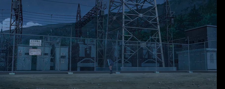
On-site comparison: Cloud cover can mimic or break the anime gradient — note weather in your travel log.
Lake Suwa Viewpoint is published as a visual-match stop for Your Name travelers. Treat the anime link as editorial context until you confirm the view on site. A wide lake-and-basin view used by fans as a landscape comparison route for Your Name-inspired travel. Lake viewpoints depend heavily on weather and season; the guide describes the landscape context fans usually compare.
Photo approach: A cloudy day can match muted palettes better than harsh midday sun.
Suggested time on site: 45-75 minutes depending on weather and transport waits. Use Kamisuwa Station as your orientation point when linking this stop with others in Suwa.
Scene comparison
Real location vs anime scene
Visit basics
- Address
- Lake Suwa, Nagano
- Nearest station
- Kamisuwa Station
- Walk time
- 18 minutes
- Coordinates
- 36.0482, 138.0837
- Related anime
- Your Name
- City guide
- Suwa anime locations
On-site experience
What it feels like to visit
A wide lake-and-basin view used by fans as a landscape comparison route for Your Name-inspired travel. At Lake Suwa Viewpoint, the travel value is understanding how locals use the space: commuters, worshippers, shoppers, or campers depending on the area.
Plan a short, respectful pause, then link the stop with another Suwa location so the day reads as a route instead of a checklist.
How to get there
From Kamisuwa Station (18 min walk)
From Kamisuwa Station, walk roughly 18 minutes on public streets toward Lake Suwa, Nagano. Final blocks may involve stairs, shrine paths, or one-way lanes not obvious from the map zoom level.
If the area feels residential or busy, keep the visit under 45-75 minutes and move to the next mapped stop.
- Start at Kamisuwa Station and pick the exit that shortest-walk maps to Lake Suwa, Nagano.
- Walk the normal pedestrian route for about 18 minutes, keeping to marked sidewalks and shrine or temple approaches.
- Pause where foot traffic allows, compare the scene cue with a wide shot, then move on if the area gets crowded.
- Connect to the next Suwa location on the map if time allows.
Quick visit note
From Kamisuwa Station, allow about 18 minutes on foot to reach Lake Suwa Viewpoint. Check the map for the final block because small slopes, one-way streets, or shrine paths can change the last approach. Camping and lakeside roads may require a rental car or bus beyond the nearest station — confirm access before travel.
Etiquette
Do not enter private property, school grounds, or staff-only areas even if a view looks closer from inside.
Nearby in Suwa
More stops on the same route

Suwa Taisha Shrine
A major Suwa shrine complex that grounds lake-and-basin Your Name travel in local worship context before wider Nagano landscape comparisons.
Kami-Suwa Station
The lakeside JR stop where Your Name travelers step off before walking toward Suwa basin viewpoints and shrine approaches.
Okaya Station Area
A Chuo Line junction south of Suwa Lake where rail travelers reposition before bus or taxi legs toward wider Your Name landscape stops.